Effortlessly count trees and measure forest carbon using precision analytics and high resolution satellite data.
Transparent Carbon Mapping Tools
Click an icon to learn more
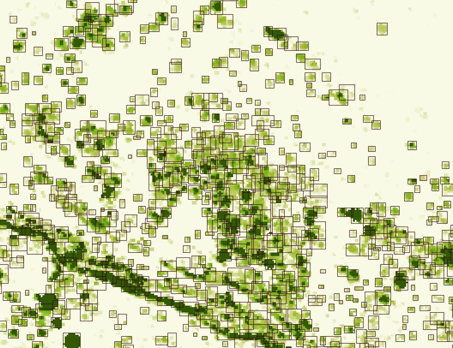 Tree Counts
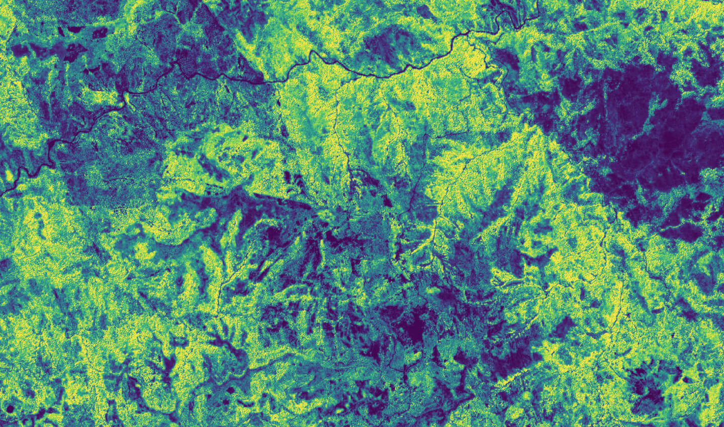 Tree Carbon
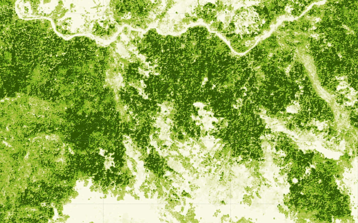 Tree Height
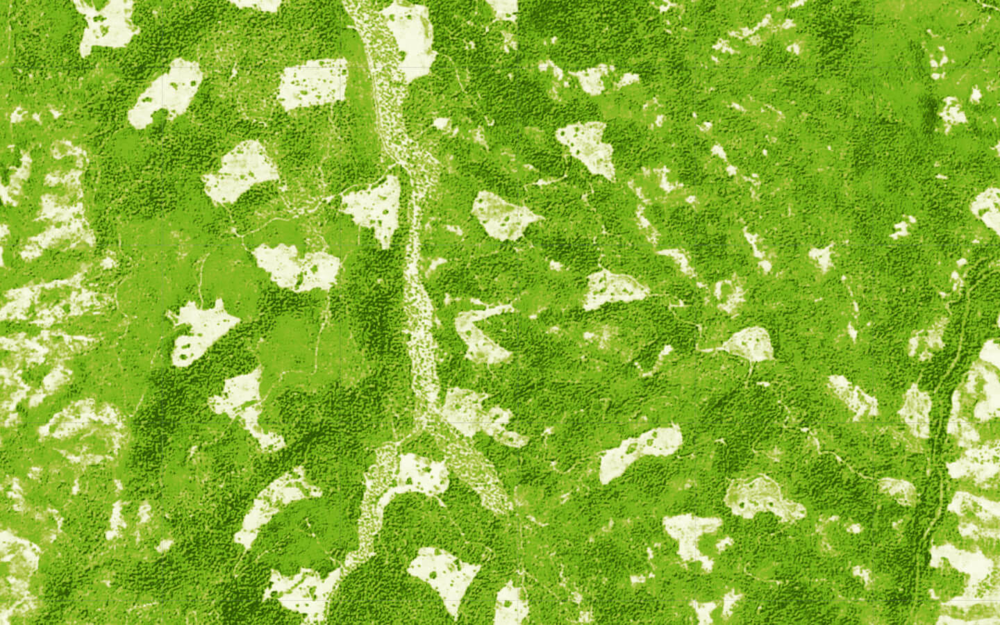 Tree Cover
Monitor Your Landscape in Tree-scale Detail
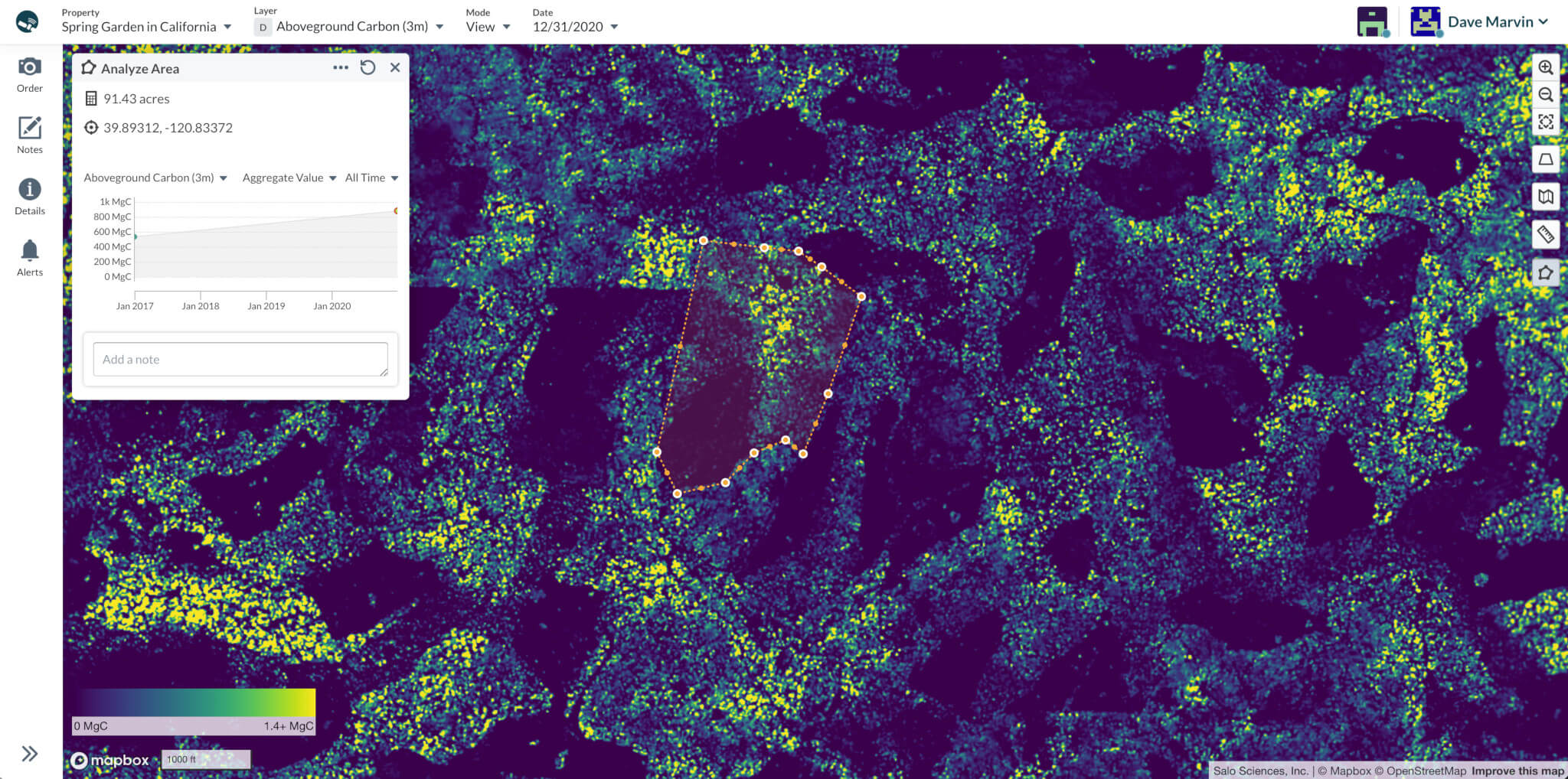
Get precision insights into carbon stocks and reforestation progress with Lens for Carbon, a next-generation conservation monitoring system with rich quantitative analysis features
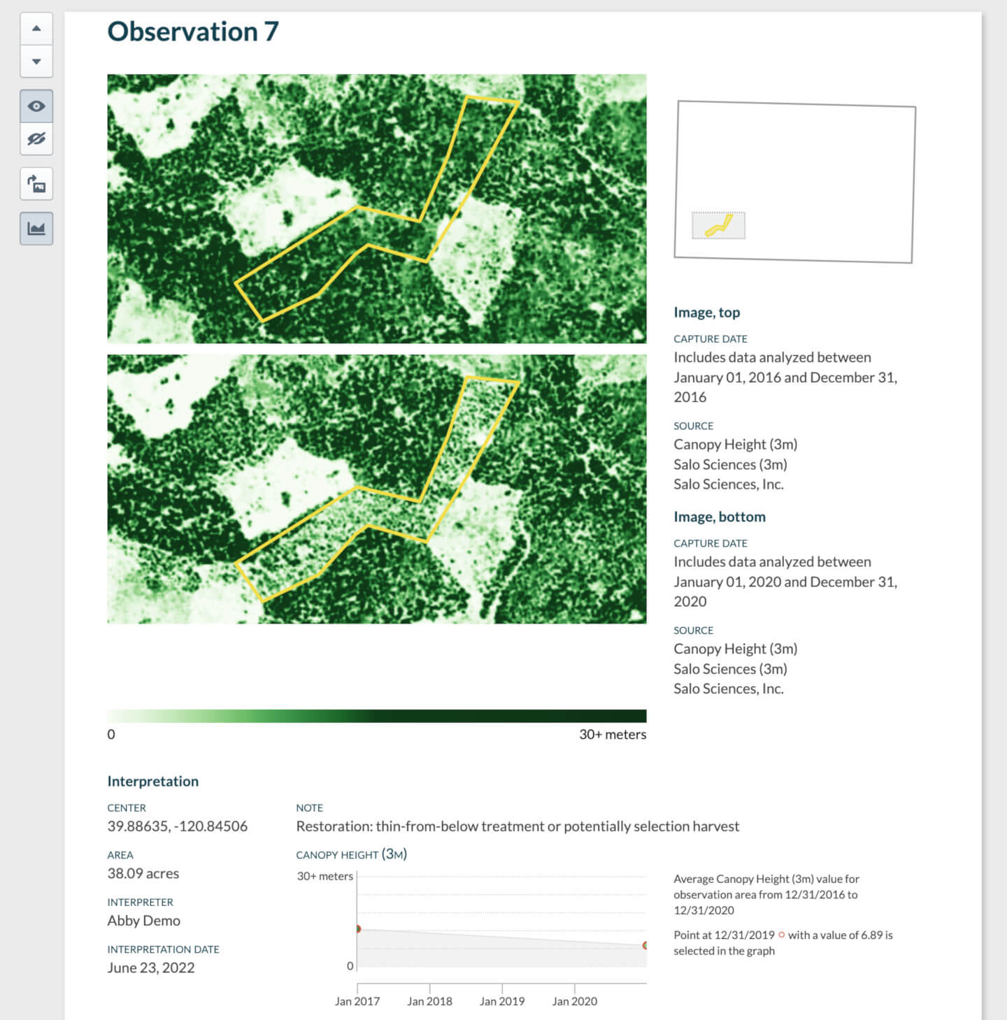
Rapidly Iterate on Planning and Evaluation

Backed by Peer-reviewed Science
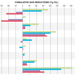
 Spatially explicit analysis of field inventories for national forest carbon monitoring
Carbon balance and management