Jul 31, 2018
by David Marvin and Christopher Anderson
Global forest loss and climate change are two of the most intractable issues of our time. While they may appear to be separate, they are inextricably linked. Forest loss accelerates climate change by releasing the carbon stored in the trees to the atmosphere, and we’re losing forests worldwide at an alarming rate.
Following a dramatic decline through the 1990s, global deforestation has rebounded in a big way (Source: Global Forest Watch)
The failure to substantially curb forest loss and climate change has perpetuated the notion that these problems are unsolvable. Yet it is their very linkage that provides a clear path to their resolution—protecting and restoring forests can pull massive amounts of CO2 from the atmosphere. Fighting climate change and forest loss will require developing solutions that match the scale of the problems. We started Salo to help build these solutions using global-scale satellite data and high-throughput analytics, driven by fundamental ecological science.
The scale of solutions
Land use change, deforestation & forest degradation contribute more than 10% of greenhouse gas emissions every year. Yet reducing land-based emissions is not enough to stop climate change—these reductions must be coupled with other massive reductions in energy, industry, and transportation emissions. Considering the magnitude of the problem, we need practical methods to pull carbon dioxide back out of the atmosphere to avoid the catastrophic impacts of climate change.
Forest growth is the most powerful atmospheric CO2 extraction technique
Research led by The Nature Conservancy found that strategically investing in nature, through restoration and conservation, can provide nearly 40% of the greenhouse gas reductions needed to keep a global temperature increase under 2°C. These strategies, known as natural climate solutions, include reducing forest loss, planting new forests, increasing cover crops & restoring grasslands, wetlands, and other natural areas. This research found that improving forest stewardship is the most mature, and the most cost-effective, natural climate solution available; potentially accounting for two-thirds of global land-based emissions mitigation.
Implementing these strategies will require a major transformation in land use. We still need land for housing, agriculture & natural resources. Can we optimize where we invest in natural climate solutions while balancing the demand for land from other industries? How do we integrate local management practices to state and national levels to match the scale of emissions reductions required? And can we do it soon enough to slow the now-rapid pace of climate change?

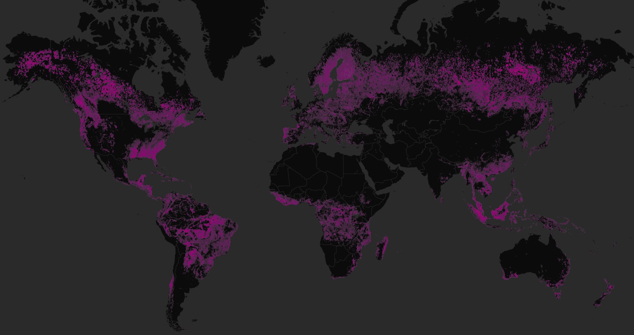
The dramatic extent of forest loss since 2000 (Source: Global Forest Watch)
Conservation analytics
Addressing the questions above will require a sophisticated approach to land management. Fortunately, we have more data than ever before on the state of the Earth’s ecosystems. New technologies, like satellites, sensor networks & cloud computing, enable scientists to understand our planet in incredible detail. Yet harnessing these technologies for conservation remains a major challenge—it is not easy to derive actionable and easy-to-understand information from these big data sources.
Many governments and conservation groups can’t perform comprehensive conservation monitoring – we can
Salo is working to map and monitor forests worldwide by applying cutting edge analytics to high resolution, globally-available satellite imagery. Yet monitoring forests from space is a major challenge. It takes years of scientific and technical specialization—including massive computational resources—to process millions of satellite images and turn them into a useful, accurate data on forest loss, growth & health.
We believe governments, non-profit organizations & other land owners implementing natural climate solutions should have access to the same technology and analytics available to companies and universities. Leveraging these technologies for conservation will help us work with nature in the fight against climate change, helping identify opportunities to implement natural climate solutions, monitor the effectiveness of new management practices & better predict where investing in conservation will have the biggest impact.
New data, new solutions
Salo was founded by two forest ecologists with 25 years of combined experience working with conservation organizations, government agencies & academic institutions. What makes us unique among ecologists is our technology expertise. We have extensive experience linking traditional ecological analysis with satellite imagery and high-throughput analytics, deriving new insights on forest health on large scales. Many talented data scientists and engineers analyze satellite imagery, but most of this work is done to support major commercial industries like agriculture, retail & mining. Few have the expertise in ecology needed to produce actionable information for conservation from satellites. We do.
We’re automating satellite image analysis for conservation—like facial recognition for forests
Salo is building automated data processing systems to analyze large volumes of data from next-gen satellites using custom artificial intelligence algorithms. Similar algorithms have transformed other industries: farmers use real-time image analysis to identify healthy crops; music streaming services automatically identify songs we’ll love; and the internet is even indexed by AI.
Using our high-throughput satellite analytics, we aim to produce actionable data to support conservation and climate change mitigation. What sets us apart from other analytics groups is our experience, our commitment to forest conservation & our dedication to mitigating climate change. We measure our success based on the area we help conserve and the CO2 we help remove from the atmosphere.
We hope to work with you in support of these goals—get in touch with us directly and sign up for email updates.